Grün4KRITIS advisory board meeting discusses regional perspectives on climate risks and the protection of critical infrastructure

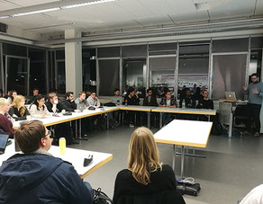
On 22 May 2025, the third advisory board meeting of the Grün4KRITIS project took place in the Rudolf Chaudoire Pavilion at TU Dortmund University. The aim of the EU-co-funded project is to systematically identify and evaluate the potential of green infrastructure (GI) to protect critical infrastructure (CI) from the effects of climate change in the Ruhr region. The meeting offered the approximately 25 participants from research and planning practice – including representatives from EGLV, VRR, LZG.NRW, BMR, UBA, BBSR, BBK, DWD – a comprehensive insight into the current status of the project and served to jointly develop key work packages.
The main topics discussed were the findings to date on regional climate impacts and the cascade chains developed in the project, which map the effects of extreme weather events such as heat, heavy rain, flooding and strong winds on CI in the health and transport sectors. In this context, the results of previous workshops were also presented at the advisory board meeting, in which, for example, concrete potentials of GI for interrupting such chains of effects were identified. In addition, approaches to defining CI with regional significance were discussed. While the nationwide CI definition focuses heavily on centralised thresholds, the project is developing a methodology that also takes into account aspects such as spatial redundancies, accessibility and functional supply relationships.
As part of the analysis of regional climate impacts, the spatial distribution of climate risks in the Ruhr area is being systematically recorded. Based on GIS-supported data evaluations, hotspots for various extreme weather events can be identified. The discussion highlighted the importance of interdisciplinary cooperation in identifying complex hazard situations and evaluating them across disciplines. Overlaying these hotspots with spatially locatable CI allows the identification of particularly vulnerable areas. These findings will be incorporated into the selection of pilot areas in which the protective effect of GI will be investigated in the context of in-depth modelling. Based on this, recommendations for action for planning and disaster prevention will be derived.
Finally, reference was made to upcoming events, including a participatory mapping workshop in October, in which representatives from science, practice and authorities will spatially locate and map specific cascade chains. The discussions once again showed how closely climate adaptation, planning and disaster control must be considered together in order to strengthen the resilience of critical infrastructure in the Ruhr area in the face of increasing extreme weather events.


